
Tour Name
7 Days Machame Route Kilimanjaro
Route Overview
Short Description
The 7 Days Machame Route Kilimanjaro is a challenging yet rewarding climb, ideal for better acclimatization. Known as the "Whiskey Route," it offers steeper trails, longer distances, and tented camps. Starting at Machame Gate in the southern base, climbers trek through lush rainforests, ascend to the Shira Plateau, and traverse the Southern Circuit, enjoying breathtaking views from various angles. The summit approach is from the east, with climbers reaching Uhuru Peak. The descent follows the Mweka Trail. With an extra day for acclimatization, this route provides the best opportunity for a successful summit. Thanks for booking with us 7 Days Machame Route Kilimanjaro

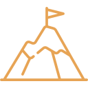
Challenging
Trekking Peaks
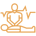
Rescue Team

Finest Accommodation
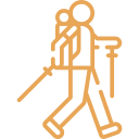
Private Guided
Detailed Itinerary
Day 0
Arrival at Kilimanjaro International Airport
Upon your arrival at Kilimanjaro International Airport a Hazina Afrika visa specialist will greet you in the Arrivals area and assist you with obtaining your tourist visa (tourist visa fee is included), help collect your luggage and accompany you through customs and escort you to a Hazina transfer representative who will be waiting outside the secured area to warmly welcome you to Tanzania. The road transfer to your hotel in Arusha will be approximately one hour. After check-in, your transfer rep will brief you on the following day’s schedule, review a safari safety check list and answer any questions you may have. Dinner and overnight at The African Tulip Boutique Hotel in a Deluxe Room.
Day 1
Machame Gate (1790m) to Machame Camp (3010m)
The Kilimajaro Trek Machame Route will start with a drive from Arusha to the Machame Gate takes about 1.5hrs. The journey passes through the village of Machame which is located on the lower slopes of the mountain. As we leave the park gate, we walk through the dense rain forest on a winding trail up a ridge until we reach the Machame Camp.
- Meal Plan: Lunch on route either hot lunch or packed lunch.
- Elevation : 5,380 ft to 9,350 ft
- Distance : 11 km/7 miles
- Hiking Time : 5-7 hours
- Habitat : Rain Forest
Day 2
Machame Camp (3010m) to Shira Camp (3845m)
We leave the glades of the rain forest and continue on an ascending path up to a steep, rocky ridge. On the Shira Plateau, we pass through heather and open moorlands, then cross a large river gorge to Shira 2 Camp.
- Meal Plan: Lunch on route either hot lunch or packed lunch.
- Elevation : 9,350 ft to 12,500 ft
- Distance : 5 km/3 miles
- Hiking Time : 4-6 hours
- Habitat : Heath
Day 3
Shira Cave (3845m) to Barranco Camp (3960m)
We continue to the east up a ridge and then head southeast towards the Lava Tower – a 300 ft tall volcanic rock formation. Through the Senecio Forest, we descend down to Barranco Camp to an altitudinal level of 13,000 ft. Even if you start and end at the same altitude, it is very beneficial for acclimatization.
- Meal Plan: Lunch on route either hot lunch or packed lunch.
- Elevation : 12,500 ft to 15,190 ft
- Distance : 7 km/4 miles
- Hiking Time : 4-5 hours
- Habitat : Alpine Desert
Day 4
Barranco Camp (3960m) to Karanga Camp (3963m)
We begin the day by descending into a ravine to the base of the Great Barranco Wall. Then we climb the non-technical but steep, nearly 900 ft cliff. From the top of the Barranco Wall we cross a series of hills and valleys until we descend sharply into Karanga Valley. One more steep climb up leads us to Karanga Camp. This is a shorter day meant for acclimatization.
- Meal Plan: Lunch on route either hot lunch or packed lunch.
- Elevation : 13,044 ft to 13,106 ft
- Distance : 5 km/3 miles
- Hiking Time : 4-5 hours
- Habitat : Alpine Desert
Day 5
Karanga Camp (3963) to Barafu Camp (4640m)
We leave Karanga and hit the junction which connects with the Mweka Trail. We continue up to the rocky section to Barafu Hut. At this point, you have completed the Southern Circuit, which offers views of the summit from many different angles. Here we make camp, rest and enjoy an early dinner to prepare for the summit day. The two peaks of Mawenzi and Kibo are viewable from this position.
- Meal Plan: Lunch on route either hot lunch or packed lunch.
- Elevation : 13,106 ft to 15,331 ft
- Distance : 4 km/2 miles
- Hiking Time : 4 km/2 miles
- Habitat :Alpine Desert
Day 6
Barafu Camp (4640m) to UHURU PEAK (5895m) & down to Millennium Camp (3790m)
Very early in the morning, around midnight, we begin the final push to the summit, tackling the most physically and mentally demanding part of the trek. The cold and wind at this altitude can be intense, but the reward is unforgettable. After several hours of steady ascent, you’ll witness a stunning sunrise near Stella Point (18,900 ft) with views of Mawenzi Peak. Reaching Uhuru Peak, the highest point on Mount Kilimanjaro and Africa, will be a triumphant moment. After celebrating at the summit, we descend to Mweka Camp, passing Barafu for lunch. Rest and enjoy your last dinner on the mountain.
Barafu Camp to Uhuru Peak
Elevation: 15,331 ft to 19,341 ft
Distance: 5 km/3 miles
Hiking Time: 7-8 hours
Habitat: Arctic
Uhuru Peak to Mweka Camp
Elevation: 19,341 ft to 10,065 ft
Distance: 12 km/7 miles
Hiking Time: 4-6 hours
Habitat: Rain Forest
Day 7
Trek Millennium Camp (3790m) to Mweka Gate (1630m)
On our last day of Kilimajaro Trek Machame Route , we continue the descent to Mweka Gate and collect the summit certificates. At lower elevations, it can be wet and muddy. From the gate, we continue another hour to Mweka Village. A vehicle will meet us at Mweka Village to drive us back to the hotel in Arusha.
- Meal Plan: Lunch on route either hot lunch or packed lunch.
- Elevation : 10,065 ft to 5,380 ft
- Distance : 10 km/6 miles
- Hiking Time : 3-4 hours
- Habitat : Rain Forest
Details
WHAT'S INCLUDED
- Park fees
- All activities mentioned (unless clearly labelled as optional)
- Meals (as specified in the day-by-day description)
- All accommodation mentioned (unless clearly labelled as an optional upgrade)
- Transportation to & from the Kilimanjaro gate
- All Taxes/VAT
- Team Kilimanjaro Rescue fees
- Friendly and professional mountain guides, cook and porters
- Enough treated & filtered drinking water throughout the trek
- Portable oxygen tanks
- Portable flush toilet from Group of 4 if your less than 4 you will pay extra 95$
- Double layered Sleeping Mats 4 inches (10cm) thick
- Fair wages for the mountain crew as approved by the Kilimanjaro National Park Authority (KINAPA), Kilimanjaro Association of Tour Operators (TLTO And TATO)
- 4 Season mountain tents
- Camping fees
WHAT'S EXCLUDED
- International flights (from/to the client’s home country)
- Additional accommodation before and at the end of the tour
- Tips: tipping guideline of per person per day for the guide and crew
- Personal items (souvenirs, travel insurance, visa fees and other personal items)
- The government imposed an increase in taxes and/or park fees
- Lunches, dinners and drinks at your hotel before and after climb.
- Surcharge for online payment of balance (5%)